Getting to Rogers is easy. Learn how here.

Getting Here & Around

Fly Into XNA

Located in the heart of Northwest Arkansas, Rogers is conveniently located near I-49 and Highways 62, 71 and 102. It’s just 15 minutes from Northwest Arkansas National Airport (XNA), which has almost 40 flights daily by American Airlines, Delta, United, Breeze, Frontier, and Allegiant Air to 22 destinations. While you’re here, arrange for car rental, shuttle or taxicab transportation to get you where you need to go.

Find options below.

XNA Flight Map
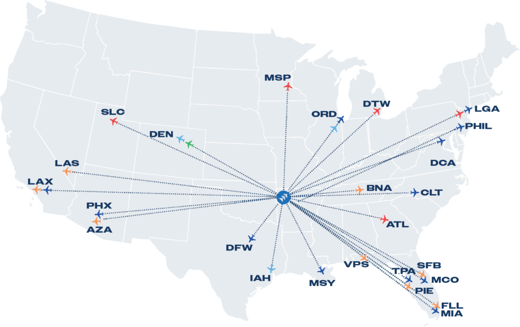
Map of the U.S. showing air routes from a central airport to various destinations, marked by airport codes such as MSP, DEN, ORD, DFW, and ATL. Ideal for planning trips to meeting venues in Rogers or connecting through major hubs.

Driving Distances to Rogers, AR

Oklahoma City3.5 hours
Tulsa2 hours
Dallas5.5 hours
Branson2 hours
Baton Rouge9 hours
St. Louis5 hours
Memphis5 hours
Jackson7.5 hours
Nashville8 hours
Kansas City3 hours
Chicago9 hours

Planning Resources

Plan Your Trip

Category
  • places to stay
  • plan your trip
filter

Transportation

Category
  • Transportation
filter
Location
  • Surrounding Areas
  • Lowell
  • Downtown Rogers
  • Midtown Rogers
  • Uptown Rogers
filter
Amenities
  • Monday Hours
  • Tuesday Hours
  • Wednesday Hours
  • Thursday Hours
  • Friday Hours
  • Saturday Hours
  • Sunday Hours
filter
View By: Grid Map

Attend a Show

Experience the Amp

An outdoor amphitheater for all kinds of music fans. Gather with fellow music fans for an unforgettable night under the stars, as you claim your seat or spread out a picnic blanket to enjoy live performances by legendary bands and talented musicians at Walmart Arkansas Music Pavilion.

Learn more
@DestinationRogersAR

Get Connected