Get Connected
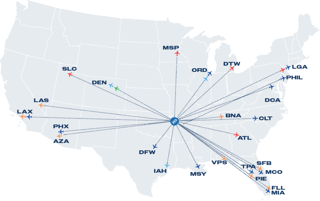
Rogers is easy to get to and easy to get around.
Maps & Travel Info
Below, find maps and travel information on getting here and to local places of interest—including the locations of shopping and retail destinations, restaurants, spas and attractions.
If you’re planning a trip to Rogers, Arkansas, you’re in for a delightful experience in one of the region’s most charming destinations. Known for its natural beauty and welcoming atmosphere, Rogers offers a variety of attractions that make it a perfect spot for your next vacation. To ensure you make the most of your time here, having the right maps and travel information is essential.
Rogers is a vibrant city nestled in the scenic Ozarks, and it’s packed with activities for all interests. Comprehensive maps will help you navigate the city’s main attractions. From cruising through the Ozark National Forest to walking in the historic downtown area, you will find unique shops, restaurants, and cultural sites.
Rogers is centrally located in the middle of Northwest Arkansas, making it easily accessible to surrounding cities such as Bentonville and Fayetteville. It’s also the perfect hub for a road trip – conveniently situated near major highways, including US Route 66, a classic American road trip route. Embarking on a road trip along this iconic route provides an opportunity to experience the nostalgic charm of small-town America while easily accessing Rogers and other nearby attractions.
When planning your vacation, it’s helpful to use various resources to get an overview of what Rogers has to offer. Stop into the Rogers Lowell Chamber for detailed maps and travel guides. You can also find guides at Arkansas.com to plan your route and find interesting stops along the way. With the right resources and information, you can tailor your itinerary to include all the highlights that make Rogers a memorable destination.
